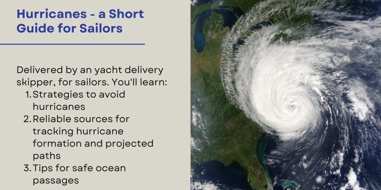
Sailing the open ocean offers unparalleled freedom and adventure, but with that freedom comes the responsibility of staying informed about weather patterns, especially hurricanes. Tracking a hurricane for sailors is a short guide to help sailors understanding how to track them and avoid risk. It’s a necessity that can make the difference between a safe passage and a perilous journey.
Having spent countless hours navigating the seas, I’ve learned that preparation and knowledge are our best allies against nature’s most formidable forces. This guide aims to provide fellow sailors with comprehensive insights into hurricane tracking, offering practical advice, resources, and techniques to help you stay ahead of the storm.
Understanding Hurricanes
What Is a Hurricane?
A hurricane is a type of tropical cyclone—a rotating low-pressure weather system that forms over warm tropical waters. Hurricanes are characterized by thunderstorms, strong winds exceeding 64 knots (74 mph), and heavy rain. They can cause significant damage due to high winds, storm surges, and flooding.
Formation and Development
Hurricanes typically form in warm ocean waters of at least 26.5°C (80°F) and require specific atmospheric conditions:
- Warm Sea Surface Temperatures: Provide the energy needed for the storm.
- Moist Air: High humidity in the lower to middle levels of the troposphere.
- Coriolis Effect: Needed to induce the cyclone’s rotation, hence they form between 5° and 20° latitude.
- Low Wind Shear: Minimal change in wind speed and direction with height allows the storm to develop vertically.
Hurricane Seasons Around the World
Understanding when and where hurricanes are likely to form is crucial for voyage planning:
- North Atlantic: June 1 to November 30, with peak activity from August to October.
- Eastern Pacific: May 15 to November 30.
- Northwestern Pacific: Typhoons can occur year-round but are most frequent from July to November.
- South Pacific and Indian Ocean: November to April.
Categories of Hurricanes
Hurricanes are classified using the Saffir-Simpson Hurricane Wind Scale:
- Category 1: 64–82 knots (74–95 mph)
- Category 2: 83–95 knots (96–110 mph)
- Category 3: 96–112 knots (111–129 mph)
- Category 4: 113–136 knots (130–156 mph)
- Category 5: 137 knots or higher (157 mph or higher)
Understanding the potential impact of each category helps in making informed decisions.
The 34-Knot Rule and the 1-2-3 Rule
The 34-Knot Rule
The 34-knot rule is a guideline used by mariners to maintain a safe distance from tropical cyclones:
- Definition: Stay outside the area where wind speeds reach 34 knots (39 mph), considered the threshold for gale-force winds.
- Application: Avoiding this area reduces the risk of encountering dangerous conditions such as high seas and severe gusts.
The 1-2-3 Rule (Danger Area Diagram)
Developed by the National Hurricane Center (NHC), the 1-2-3 rule helps sailors estimate the potential path of a hurricane and the areas of uncertainty:
- Purpose: To account for forecast errors in the hurricane’s track over time.
- Calculation:
- 24 hours ahead: Add a 100-nautical-mile (nm) radius around the forecast position.
- 48 hours ahead: Add a 200 nm radius.
- 72 hours ahead: Add a 300 nm radius.
- Usage: Plot these radii around the forecasted positions to create a “danger area” where the hurricane could potentially move.
Combining the Rules
By applying both the 34-knot rule and the 1-2-3 rule:
- Stay Clear of High Winds: The 34-knot rule keeps you away from gale-force conditions.
- Account for Forecast Errors: The 1-2-3 rule provides a buffer for the hurricane’s possible deviation from its predicted path.
- Enhanced Safety Margin: Together, they offer a conservative approach to risk management.
Sources of Hurricane Information
Staying informed is the cornerstone of hurricane preparedness. Accessing timely and accurate weather information allows for proactive decision-making.
Internet-Based Resources
With the advent of satellite internet services like Starlink, sailors can access real-time data even in the middle of the ocean.
- Starlink Maritime:
- Features: High-speed, low-latency broadband internet with coverage over coastal waters and open seas.
- Usage: Enables access to websites, weather models, and communication platforms.
- Website: Starlink Maritime
- National Hurricane Center (NHC):
- Features: Official forecasts, advisories, and graphical products.
- Website: www.nhc.noaa.gov
- NOAA Weather Resources:
- Features: Detailed marine forecasts, satellite imagery, and storm tracking.
- Website: www.weather.gov/marine
- Other Online Resources:
- Weather Underground: Offers hurricane tracking maps and models.
- Website: www.wunderground.com/hurricane
- Windy: Provides interactive weather maps with forecast models.
- Website: www.windy.com
- Weather Underground: Offers hurricane tracking maps and models.
Radio Communications
When internet access isn’t available, radio remains a reliable method for receiving weather updates.
High-Frequency (HF) and Single Side Band (SSB) Radio
- National Weather Service (NWS) Broadcasts:
- Station NMG (New Orleans):
- Frequencies: 4316, 8502, and 12788 kHz.
- Schedule: Transmits forecasts four times daily.
- Station NMF (Boston):
- Frequencies: 6340.5, 9110, and 12750 kHz.
- Schedule: Four times daily.
- Station NMG (New Orleans):
- WWV Time and Frequency Station:
- Frequencies: 2.5, 5, 10, and 15 MHz.
- Weather Updates: Includes storm warnings at 8 minutes past the hour.
NAVTEX
- What Is NAVTEX?: An international automated medium frequency service for delivering navigational and meteorological warnings and forecasts.
- Frequency: 518 kHz (English) and 490 kHz (local language).
- Range: Up to 400 nautical miles from the transmitter.
- Usage: Receives text messages that can be printed or displayed on a screen.
VHF Radio
- Weather Channels:
- NOAA Weather Radio: Provides continuous weather information.
- Channels: WX1 to WX7 (162.550 MHz to 162.525 MHz).
- Limitations: VHF is line-of-sight and typically effective up to 20-30 nautical miles offshore.
Satellite Communications
Satellite Phones and Messaging Devices
- Iridium and Inmarsat:
- Features: Global coverage for voice and data services.
- Usage: Can download weather data and communicate with shore contacts.
- Garmin inReach:
- Features: Two-way text messaging, GPS tracking, and SOS capabilities.
- Weather Forecasts: Offers basic to premium weather packages.
GRIB Files and Weather Routing Services
- GRIB Files:
- Definition: Gridded Binary files containing weather forecast data.
- Access: Download via satellite devices using services like PredictWind or Saildocs.
- Weather Routing Software:
- Examples: Expedition, TimeZero, OpenCPN.
- Functionality: Allows for route optimization based on forecasted conditions.
Obtaining Weather Information at Sea
Setting Up Reliable Communication Systems
- Redundancy: Equip your vessel with multiple communication methods (e.g., SSB radio, satellite phone, internet).
- Power Supply: Ensure adequate power generation (solar panels, wind generators) to support devices.
Scheduling Regular Weather Updates
- Routine Checks: Establish a schedule for downloading forecasts, such as every 6 or 12 hours.
- Time Zones: Be mindful of UTC (Coordinated Universal Time) when referencing forecast issuance times.
Interpreting Weather Data and Forecasts
- Understanding Forecast Terminology: Familiarize yourself with meteorological terms and symbols.
- Analyzing Models: Compare different models (e.g., GFS, ECMWF) for a comprehensive view.
- Forecast Confidence: Note the confidence level and potential for rapid changes.
Case Study: Navigating Around Hurricane Lorenzo
In September 2019, Hurricane Lorenzo became the easternmost Category 5 hurricane on record in the Atlantic. A sailing vessel en route to the Azores had to adjust its course:
- Actions Taken:
- Monitoring: Regularly downloaded forecasts via satellite phone.
- Application of the 1-2-3 Rule: Plotted the danger area and planned accordingly.
- Course Adjustment: Diverted south to stay clear of the projected path.
- Outcome: Successfully avoided the hurricane with minimal delay.
Hurricane Tracking Techniques
Analyzing Weather Charts and Models
- Surface Analysis Charts: Show current positions of high and low-pressure systems, fronts, and storms.
- Forecast Charts: Provide predicted positions over 24, 48, and 72 hours.
- Tropical Cyclone Forecast/Advisory: Detailed information on the cyclone’s position, intensity, and forecasted movement.
Understanding Forecast Cones and Uncertainty
- Cone of Uncertainty:
- Definition: Graphic representation of the probable track of the storm center.
- Interpretation: The storm can move anywhere within the cone, and impacts can occur outside it.
- Wind Radii:
- Depicts: Extent of tropical-storm-force and hurricane-force winds.
Utilizing Weather Routing Software
- Route Optimization:
- Input: Vessel’s polar diagrams (performance data) and weather forecasts.
- Output: Suggested routes that minimize exposure to adverse conditions.
- Examples:
- PredictWind Offshore: Integrates multiple weather models and provides route suggestions.
- Squid Sailing: Offers high-resolution forecasts and routing options.
Comparing Different Forecasting Models
- Global Forecast System (GFS):
- Provider: NOAA.
- Update Frequency: Four times daily.
- European Centre for Medium-Range Weather Forecasts (ECMWF):
- Reputation: Often considered more accurate, especially for longer-range forecasts.
- Access: Available through certain services due to licensing.
- Consensus Approach:
- Method: Comparing multiple models to identify common trends.
- Benefit: Reduces reliance on a single forecast, enhancing decision-making.
Decision-Making and Risk Management
Evaluating the Threat Level
- Assessing Forecasts: Determine the likelihood of the hurricane’s impact based on current data.
- Trend Analysis: Observe whether the storm is intensifying or weakening.
Deciding When to Alter Course or Seek Shelter
- Early Action: It’s better to make course changes sooner rather than later.
- Sheltering Options:
- Ports and Harbors: Evaluate the safety and facilities available.
- At Sea: Sometimes safer to remain at sea, well clear of land and shoals.
Coordination with Crew and Other Vessels
- Communication: Keep the crew informed about the situation and plans.
- Networking:
- Maritime Mobile Service Network: SSB radio network for sharing information.
- Cruiser Nets: Regular radio schedules where sailors share updates.
Expert Opinions on Best Practices
- Captain Fatty Goodlander:
- Advice: “The ocean is always safer than the lee shore. When in doubt, get off soundings and give yourself room.”
- Lin Pardey:
- Wisdom: “Preparation and self-reliance are your best defenses against the unpredictability of the sea.”
Preparation and Safety Measures
Preparing the Vessel for Heavy Weather
- Securing Gear: Stow all loose items securely both above and below deck.
- Reinforcing Rigging: Inspect shrouds, stays, and halyards for wear.
- Storm Sails: Ensure storm jib and trysail are accessible and in good condition.
Emergency Equipment and Protocols
- Liferaft and Ditch Bag:
- Contents: Water, food rations, signaling devices, first aid kit.
- Personal Safety Gear:
- Harnesses and Tethers: Mandatory during rough conditions.
- Life Jackets: Equipped with lights and whistles.
Developing a Hurricane Action Plan
- Pre-Departure Planning:
- Route Flexibility: Incorporate alternate routes and ports of refuge.
- Crew Training: Conduct drills for man-overboard, abandon ship, and heavy weather tactics.
- During Passage:
- Regular Briefings: Keep everyone informed and involved.
- Documentation: Maintain a log of decisions and actions taken.
Checklists for Readiness
- Mechanical Systems:
- Engine Maintenance: Check fluids, belts, and filters.
- Bilge Pumps: Test manual and electric pumps.
- Electrical Systems:
- Battery Health: Ensure sufficient charge and capacity.
- Navigation Lights: Verify all lights are functioning.
- Provisions:
- Food and Water: Stock extra supplies in case of delays.
- Medical Supplies: Update first aid kit and personal medications.
Conclusion
Navigating the vast oceans requires respect for nature’s power and a commitment to preparedness. By understanding hurricanes, utilizing available resources, and applying proven techniques like the 34-knot rule and the 1-2-3 rule, we can significantly enhance our safety at sea.
Stay vigilant, prioritize regular weather updates, and don’t hesitate to adjust your plans in the face of changing conditions. Remember, the goal is not just to reach your destination, but to do so safely while preserving the well-being of your crew and vessel.
Resources and References
- National Hurricane Center: www.nhc.noaa.gov
- NOAA Weather Radio: www.weather.gov/nwr
- PredictWind: www.predictwind.com
- Saildocs (GRIB File Requests): www.saildocs.com
- Starlink Maritime: www.starlink.com/maritime
- Maritime Mobile Service Network: Frequencies and schedules can be found online.
Tables and Lists
Table 1: SSB Radio Frequencies for Weather Updates
| Station | Frequency (kHz) | Schedule (UTC) |
|---|---|---|
| NMG (New Orleans) | 4316, 8502, 12788 | 0330, 0930, 1530, 2130 |
| NMF (Boston) | 6340.5, 9110, 12750 | 0500, 1100, 1700, 2300 |
Checklist: Essential Emergency Equipment
- Life Raft
- EPIRB (Emergency Position Indicating Radio Beacon)
- Personal Flotation Devices (PFDs)
- Harnesses and Tethers
- Flares and Signal Mirrors
- First Aid Kit
- Ditch Bag with Supplies
- Satellite Phone or Messenger
Final Thoughts
Embracing the responsibility of hurricane tracking empowers us as sailors. It allows us to make informed decisions, protect our vessels, and most importantly, ensure the safety of all souls on board. Equip yourself with knowledge, stay connected with reliable resources, and respect the ever-changing moods of the sea.
Safe sailing, and may your journeys be guided by fair winds and clear skies.


