

Sailing in Gibraltar – How to cross the Strait of Gibraltar?
Sailing through the Strait of Gibraltar into the Atlantic Ocean requires thorough planning due to the intricate interplay of currents and weather conditions. Dominant currents flow from the Atlantic into the Mediterranean, with the strongest in the middle. Favorable tides and wind forecasts are often indispensable to help you go forward. You’ll need to study tide tables carefully to identify best windows for your sailing passage. To mitigate potential orcas interactions, check local WhatsApp and Facebook groups and avoiding hotspots where killer whales was actual observed . Use up-to-date nautical charts like Admiralty Chart 1448, read actual Reeds Nautical Almanac to check tides and read Pilot Books for localized advice. Local weather, influenced by Poniente and Levante winds, plays a pivotal role, so stay updated with weather forecast maritime advisories. Explore further to master the intricacies of this passage.
Make sure your vessel is well-prepared for sudden changes in conditions, and always have contingency plans. Proper planning guarantees not just a successful crossing but also a safe and enjoyable experience for you and your crew.
Currents in the Strait
Understanding the currents in the Strait is essential for traversing this narrow and dynamic waterway efficiently and safely. The dominant current flows from the Atlantic into the Mediterranean, driven by tidal changes and wind patterns. You’ll often find the strongest currents closer to the middle of the Strait, while weaker currents prevail along the coastlines.
There are untypical phenomena known as Boiling Water Effect, named by Spanish fishermen as “hervideros” or ““hileros de corriente”. They were observed from satellites last years. They are caused be three factors:
- Atlantic, West going current. Upper, less salty and colder Atlantic water flow East. Warmer, more salty flow in lower areas West. The border of this powerful “rivers” is approx 100 meters under water.
- Camarinal Sill – underwater, rocky barrier which block and push West going Mediterranean water closer to the surface
- Tides. The attraction of the moon and the centrifugal force related to the Earth’s rotation move water
Boiling Water Effect was described in old, English Sailing Directory from 1840 and later in Spanish Sailing Directories. Warning can be translated as follows:
“They appear instantaneously without previous signs. Suddenly a roughness in the sea surface appears as when the water is boiling, and a surfing chaotic sea is established. If wind and wind-induced forces are considered, the streamers are dangerous not only for smaller ships but for bigger ships also. Sometimes the vessel acquires a vortex motion without steerage”.
https://www.sciencedirect.com/science/article/abs/pii/S0967064502001443
Timing your crossing the Strait of Gibraltar to coincide with favorable tides can greatly ease your passage. Be mindful of the easterly Levante and westerly Poniente winds, which can amplify the currents and complicate navigation.
Navigation and Passages
When traversing the Strait of Gibraltar, you’ll need to take into account various routes, such as sailing west through the Strait to Lisbon or crossing from Gibraltar to the Canary Islands. Each passage has its own set of challenges and ideal sailing conditions. For instance, the journey from Tangier to Gibraltar and back, as well as the longer voyage from Mallorca to Gibraltar, requires careful planning to manage currents and weather effectively.
Respect Traffic Separation scheme!

West through the Strait
Sailing west through the Strait of Gibraltar requires careful planning to counteract the region’s powerful tidal currents and unpredictable weather conditions. When sailing across the strait from west to east, you’ll encounter the strong Gibraltar current, which can greatly impact your passage. To guarantee a smooth Strait of Gibraltar crossing, consider these key points:
- Timing: Plan your departure during slack tide to minimize current impact.
- Weather: Monitor forecasts closely to avoid sudden changes.
- Navigation: Use detailed charts for precise navigation.
- Orcas: Be prepared for orcas interaction by knowing common sighting areas.
Sailing from Gibraltar to Lisbon, Portugalhttps://amzn.to/3VJrbSY


Planning the route from Gibraltar to Lisbon involves careful passage planning to tackle the variable winds and currents of the Atlantic Ocean. You’ll need to take into consideration the tidal water flows as you exit the Strait of Gibraltar. Timing your departure to coincide with favorable tides can greatly impact your sailing speed and fuel efficiency.
Be mindful of the notorious orcas interaction along this route. They’ve been known to approach sailboats, especially around the Iberian Peninsula. Make sure your vessel’s hull and rudder are well-protected, and maintain a vigilant watch.
Navigating from Gibraltar to Lisbon requires a keen understanding of the Atlantic’s temperament. Always have contingency plans and regularly check weather forecasts to adapt to changing conditions. This caution ensures a smoother and safer voyage.
Crossing from Gibraltar to the Canary Islands

Sailing from Gibraltar to the Canary Islands demands a profound understanding of the prevailing wind patterns and ocean currents to ensure a successful passage. You’ll need to navigate the challenging waters of the Strait of Gibraltar, where conditions can be unpredictable.
Key considerations include:
- Key: The northeast trade winds typically prevail, but be prepared for sudden changes.
- Ocean Currents: Strong currents flow eastward through the Strait; plan your crossing around these.
- Route Planning: A direct route may not always be the best;
- Safety Measures: Equip your yacht for potential heavy weather and make sure all safety gear is in top condition. Always prepare a passage plan with Refugee Ports
Sailing from Tangier to Gibraltar and back

Traversing from Tangier to Gibraltar and back necessitates a vital awareness of the Strait’s unique tidal patterns and wind shifts, guaranteeing a seamless journey through this bustling maritime passage. You’ll need to monitor the tidal water flows closely; the eastward flow occurs during high tide, while low tide favors westward movement. This knowledge is essential for efficient sailing. Additionally, be vigilant for orcas interaction, particularly in the western approaches, and take precautionary measures to avoid them. Precision in navigation is paramount, especially in such a dynamic environment. Equip your vessel with up-to-date charts and AIS for real-time tracking and always communicate your position to other ships to ensure a safe passage.
Sailing passage: Mallorca to Gibraltar

Mastering the passage from Mallorca to Gibraltar requires a thorough understanding of Mediterranean weather patterns and precise chart plotting to guarantee a safe and efficient route. Key considerations include:
- Currents: Study tidal flows, particularly through the Alboran Sea, where currents can be unpredictable.
- Dangers: Stay vigilant for shipping lanes and underwater hazards.
- Orcas interaction: Maintain a safe distance and avoid regions with recent sightings.
- Best time: Late spring to early autumn offers the most favourable conditions.
Navigating this passage demands attention to detail and a proactive approach to potential issues. Leverage local knowledge and real-time data to adapt to changing conditions. By doing so, you’ll secure a smooth journey towards the Strait of Gibraltar.
Cruising around Gibraltar
When sailing around Gibraltar, it is crucial to pay attention to the intricate dance of currents and wind patterns to ensure a successful passage through this iconic maritime gateway. When sailing across the strait, you’ll face tidal currents that can either aid or hinder your progress. The currents typically flow eastward during the flood tide and westward during the ebb. Cruising around Gibraltar requires vigilance; the dangers lie in sudden wind shifts and the unpredictable nature of these tidal currents. Planning your passage during neap tides is vital to minimize the risks. Sailing close to shore can reduce current impact but increases the complexity due to coastal traffic. Stay informed and connected with local maritime advisories to avoid surprises.
Nautical charts and publication advised for crossing GStrait of Gibraltar
For a successful and safe passage through the Strait of Gibraltar, it is crucial to utilize up-to-date nautical charts and publications such as the Admiralty Sailing Directions (NP1) and local tide tables. These resources are indispensable for maneuvering the complex waterway and avoiding potential hazards.
Make sure to have:
- Admiralty Chart 1448: Covers the Strait in detail.
- Pilot Books: Offer insights on local conditions.
- Tide Tables: Crucial for understanding tidal flows.
- Current Atlases: Help predict current patterns.
Using these tools ensures you are well-prepared for the crossing. The Admiralty Sailing Directions (NP1) provides detailed guidance, while tide tables allow you to plan your journey with precision. With these publications, you will navigate the Strait confidently and safely.
Weather
Understanding the local weather conditions is just as important as having the right nautical charts and publications for a successful crossing of the Strait of Gibraltar. The strait’s unique geography influences its weather, making it essential to monitor forecasts closely. Westerly winds, known as Poniente, and easterly winds, called Levante, dominate the area and can greatly impact your sailing experience. Pay attention to the tidal water flows and currents, which are influenced by both the Mediterranean Sea and the Atlantic Ocean. These currents can be surprisingly strong, particularly around the narrowest points of the strait. Knowing when the currents will move your boat west or east is crucial for efficient passage planning. Stay informed and adjust your sailing tactics accordingly.
Marine Weather Forecast for Gibraltar:
Ports and marinas
You’ll want to familiarise yourself with key ports and marinas along the Strait of Gibraltar, such as Alcaidesa Marina, Marina Bay and Ocean Village, Queensway Quay, Ceuta, and Marina Smir. These locations offer essential services and safe harbour, which are vital for both preparation and contingencies. Understanding the facilities and amenities each port provides can greatly impact your voyage planning and overall safety.

Alcaidesa marina
VHF Channel 9 marina@alcaidesa.com (+34) 956 021 660
Nestled along the shores of La Línea de la Concepción, Alcaidesa Marina provides an ideal starting point for your voyage across the Strait of Gibraltar. This well-equipped marina lies within sight of the iconic Gibraltar Rock and the nearby British territory. Before setting sail, make sure you visit the Marina Office to check weather updates and file your float plan.
Key features include: – Modern facilities for maintenance and repairs – VHF communication CHANNEL 9 for constant updates and coordination – 24/7 security to guarantee your vessel’s safety – Proximity to Gibraltar for last-minute provisioning
Rely on Alcaidesa Marina’s experienced staff to assist with any pre-departure needs, ensuring a smooth and efficient start to your crossing.
Marina Bay and Ocean Village
VHF Channel 71 marinareception@oceanvillage.gi (+350) 200 73300
Marina Bay and Ocean Village offer state-of-the-art facilities and convenient access to the bustling amenities of Gibraltar, making them excellent choices for docking before or after your journey across the Strait. Situated in Gibraltar Bay, both marinas cater to visiting yachts with high-quality services. When crafting your sail plan, consider these ports for their secure berths and thorough maintenance options.
Marina Bay provides well-sheltered mooring, ideal for pre-departure checks. Ocean Village, with its vibrant social scene, allows for crew relaxation and final provisioning. Both locations make sure you’re well-prepared for the challenging waters ahead. Remember, the marinas’ proximity to essential services and their advanced facilities make them indispensable stops in your sailing itinerary.
Queensway Quay
VHF Channel 71 info@queenswayquay.com +350 20044700
Queensway Quay stands as a pivotal marina within Gibraltar, offering exceptional facilities and a strategic location for yachts preparing to navigate the Strait of Gibraltar. When moored here, you’ll find it an ideal spot to handle necessary preparations.
- Customs clearance: Efficient and straightforward, ensuring you’re ready for international waters.
- Berth availability: Ample space to secure your yacht comfortably.
- Tax benefits: Gibraltar’s favourable tax regime can save you costs.
- Comprehensive amenities: From refuelling to provisioning, everything’s at your fingertips.
Experienced mariners will appreciate the marina’s well-maintained facilities and strategic positioning. With Queensway Quay, you’re not just getting a berth; you’re gaining a trusted ally for your journey across these challenging waters.
Ceuta
VHF Channels: 12 & 16 direccion@mahersa.es (+34) 619 16 40 43
Ceuta’s strategic location on the northern coast of Africa provides an essential waypoint for yachts crossing the Strait of Gibraltar. Nestled close to the border with Morocco, Ceuta offers well-equipped ports and marinas, making it a convenient stop before heading toward the Spanish coast. You’ll find the facilities here robust and the access straightforward, especially beneficial for vessels crossing the strait.
| Port Name | Coordinates | Facilities |
| Marina Hercules | 35.8941° N, 5.3066° W | Fuel, Water, Electricity, Wi-Fi |
| Puerto Deportivo | 35.8990° N, 5.3110° W | Repairs, Supplies, Restaurants |
| Ceuta Harbour | 35.8880° N, 5.3190° W | Customs, Immigration, Security |
Utilizing Ceuta’s marinas guarantees a smooth journey during your voyage, providing all necessary amenities for a safe and comfortable trip.
Marina Smir
VHF channel 9 portmarinasmir@menara.ma +212 (3997) 7250
Situated along the Moroccan coast, Marina Smir serves as an excellent layover for yachts traversing the Strait of Gibraltar, offering extensive facilities and services for a smooth and secure journey. This marina is designed to cater to the needs of yachtsmen, ensuring that your sailing experience remains uninterrupted and comfortable.
- Berthing: Spacious berths accommodating a variety of yacht sizes.
- Security: 24/7 surveillance to protect your vessel.
- Maintenance: On-site services for any yacht delivery and repair needs.
- Amenities: Access to restrooms, showers, and dining options.
Strategically located, Marina Smir allows you to monitor tidal water flows and plan your next leg efficiently. The coast of Morocco’s unique position provides a respite before tackling the complex currents of the Strait.
Tarifa
VHF Channel: 9 apba@apba.es (+34) 956 585 400
Tarifa’s port, located on the southern coast of Spain, provides a strategic spot for yachts crossing the Strait of Gibraltar, offering essential services and a convenient refuelling point. With its proximity to the traffic separation scheme, Tarifa serves as an ideal location to monitor shipping lanes and adjust your route accordingly. Keep an eye out for bottlenose dolphins, often spotted near the port. When piloting, consider the wind knots; Tarifa is known for its strong winds, which can reach up to 30 knots. Plan your departure around high tide for best conditions. By leveraging Tarifa’s facilities and strategic location, you’ll ensure a safer and more efficient passage through one of the world’s busiest maritime corridors.
Barbate
Channel: 9 barbate@eppa.es +(34) 956 431 907
After exploring Tarifa’s strong winds and bustling port, you’ll find Barbate, another port that offers a quieter refuge with excellent marina facilities. Located on the Atlantic coast, Barbate is renowned for its vibrant fishing boats and the seasonal catch of blue tuna. The marina is well-equipped to handle the Levante winds that are common in the region.
While in Barbate, you can enjoy: – Fresh blue tuna dishes at local eateries – Charming tapas bars along the waterfront – Secure mooring with thorough services – Sheltered anchorage away from harsh conditions
Barbate’s port provides a blend of tranquillity and practical amenities, making it an ideal stopover before continuing your journey across the Strait of Gibraltar.

Frequently asked questions
In this section, you’ll find answers to some of the most common queries about sailing across the Strait of Gibraltar and beyond. Whether you’re curious about the duration of trips to the Canary Islands, the UK, or Morocco, or the exact nautical miles from Southampton to Gibraltar, we have the information you need. These insights are based on extensive experience and technical knowledge to help you plan your voyage efficiently.
How long does it take to sail from Gibraltar to the Canary Islands?
The journey from Gibraltar to the Canary Islands typically takes between five to seven days, depending on weather conditions, planned stops and the specific route taken. Sailing time can vary based on:
- Wind patterns
- Sea state
- Boat speed
- Crew experience
- Stops
The route from Gibraltar through the Strait of Gibraltar is often influenced by prevailing winds and currents. It’s essential to plan for best timing, ensuring the passage is both safe and efficient. The Canary Islands offer a rewarding destination, but careful preparation is vital. Always monitor weather forecasts and have contingency plans in place. Joining a community of experienced sailors can provide invaluable insights and support, ensuring your journey is both successful and enjoyable.
How long does it take to sail from Gibraltar to the UK?
Sailing from Gibraltar to the UK generally takes between two to three weeks, depending on prevailing weather conditions, the specific route chosen, and the performance capabilities of your vessel. Your sailing time will vary based on boat speed and the efficiency of navigation. The UK destination you aim for will also influence the overall journey time.
It’s important to monitor weather forecasts and sea conditions continuously to optimise your route. A well-maintained vessel with a reliable engine and sails will contribute greatly to a smoother voyage. Remember, efficient planning and situational awareness are key. Achieving a sense of belonging within the sailing community often comes from shared experiences and knowledge, so lean on your fellow sailors for advice and support.
How long does it take to sail the Strait of Gibraltar?
Depending on wind conditions and tidal flows, crossing the Strait of Gibraltar can take anywhere from a few hours to an entire day. Your sailboat’s speed is contingent on several factors that seasoned sailors must consider:
- Tidal water flows: These can either aid or obstruct your progress, so plan your trip around favorable currents.
- Wind conditions: Strong easterlies or westerlies can have a substantial impact on travel time.
- Challenges: Maneuvering through busy shipping lanes and avoiding orcas requires vigilance.
- Sailboat readiness: Ensuring your vessel is in top condition can prevent delays.
Understanding these elements will help you better anticipate the duration of your journey across the Strait of Gibraltar. Stay informed and prepared to ensure a safe and efficient passage.
Can you sail from Gibraltar to Morocco?
Wondering if you can sail from Gibraltar to Morocco? Absolutely, it’s a feasible and popular route. However, crossing the Strait of Gibraltar in a sailboat requires careful planning due to several dangers. Key considerations include managing the strong tidal water flows which can shift dramatically, moving your vessel either west or east depending on the timing. Be particularly cautious in areas where these currents are stronger. Additionally, the presence of orcas, known to interact with sailboats, necessitates vigilance. To avoid problems, always check tide schedules and stay informed about orca sightings. This careful preparation ensures a safe and enjoyable passage across the strait, fostering a sense of belonging among fellow sailors.
How many nautical miles is it from Southampton to Gibraltar?
If you’re planning a voyage, you’ll find that the distance from Southampton to Gibraltar is approximately 1,000 nautical miles. This route is a common path for yacht delivery and presents a mix of challenges and rewards for any experienced sailor. Here are some key points to take into account:
- Weather Conditions: Always check the forecast before departure.
- Currents: Be aware of the currents, especially near the Strait of Gibraltar.
- Navigation: Make sure your sailboat’s navigation systems are up-to-date.
- Crew Preparedness: Your crew should be well-prepared for the duration of the journey.
Navigating this stretch requires precision and expertise, making it essential to plan meticulously. Whether you’re sailing a small sailboat or a larger yacht, understanding these factors will guarantee a safer passage from Southampton to Gibraltar.
Crossing Strait Gibraltar – when to go?
Planning the ideal time to sail across the Strait of Gibraltar necessitates careful consideration of seasonal weather patterns and tidal currents to guarantee a safe and efficient passage. The best time to cross is typically in late spring or early autumn when the weather is more important. Understanding tidal water flows is vital; the currents can be strong, moving west with the flood tide and east with the ebb tide. Aim to navigate during slack water to minimize the impact of these currents. Additionally, be mindful of orcas, as they can be more active in certain seasons. Monitoring marine traffic updates and local advisories will help you avoid these marine mammals and ensure a smoother journey.
What is the best method for crossing strait of Gibraltar when heading to Canaries ?
When heading to the Canaries, the best method for crossing the Strait of Gibraltar is to plan your passage during slack water and utilize the west-moving flood tide to your advantage. This approach minimizes resistance from tidal water flows and guarantees smoother sailing.
Consider these key points:
- Best time: Depart during slack water to avoid strong currents.
- Tidal water flows: Use the west-moving flood tide for best progress.
- Orcas interaction: Maintain a steady course and avoid areas known for frequent orca sightings.
- Sailboat readiness: Make sure your vessel is well-prepared for variable conditions.
What is the best method for crossing strait of Gibraltar when heading to canaries?
Crossing the Strait of Gibraltar en route to the Canaries requires careful timing to harness the west-moving flood tide while avoiding the strait’s notorious strong currents and frequent orca sightings. The best method involves departing during the first two hours of the flood tide, ensuring the current pushes your sailboat westward. Monitor the tidal charts closely, as the current will turn eastward during the ebb tide.
Stick to mid-channel to avoid the strongest currents near the shorelines. To minimise orca interactions, maintain a steady course and avoid sudden movements. Orcas are less likely to approach steady, predictable vessels. This strategy provides a smoother, safer crossing of the Strait of Gibraltar, setting you up for a successful journey to the Canaries.
How looks Gibraltar courtesy flag?
Below you can see how courtesy flag of Gibraltar looks. Please show them every time you enter Gibraltar waters. When you click on below photo you will be redirected to Amazon shop, where you can place an order.

How looks courtesy flag of Morocco?
Below you can see how courtesy flag of Morocco looks. Please show them every time you enter Moroccan waters. When you click on below photo you will be redirected to Amazon shop, where you can place an order.

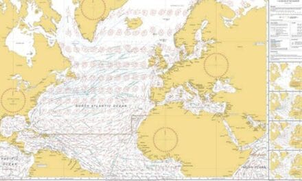
Popular routes after your Biscay Journey are in below posts:
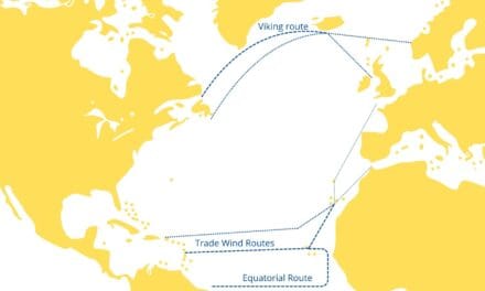
- Atlantic crossing from East to West – details regarding popular East to West Atlantic routes
- Sailing Across the Atlantic: A Comprehensive Guide for Fellow Sailors – read it before your first Atlantic passage
- Crossing Bay of Biscay by Sailboat – few words how to cross Bay of Biscay
- Sailing from UK to the Mediterranean – some datails about West to East crossing
- Atlantic crossing from West to East – details regarding popular West to East Atlantic routes
